28.04.2022

GERLACH PEAK

Gerlach Peak (Gerlachovský štít) is not only the highest peak of Slovakia and the Tatras but also of the Carpathians. Its height is 2655 m above sea level. It is located on the territory of the Tatra National Park, a beautiful natural area surrounded by glacial lakes and pine forests. It owes its name the village of Gerlachów, which was located in this area in the olden days. Please remember, that the summit can be gain only with a UIAGM certified mountain guide (or you must have such certified if you want to go alone).

Gerlach Peak, Tatra Mountains, Slovakia
Author Jozef Sámel. Gerlach Peak The highest peak of Karpatian sight from east from Velická dolina. Source commons.wikimedia.org.


WHEN WAS THE SUMMIT REACHED?

It is believed, that the summit of Gerlachovský štít was first climbed in 1834 by Ján (Johann) Still, a teacher and mountain guide from Nová Lesná, accompanied by his brother-in-law Gellhof, the miller Martin Urban Spitzkopf, and two unknown by name chamois hunters.

The first women to stand on the summit of Gerlach were Viennese tourists Paulina Knerr and Josephine Fillunger, July 28, 1877.

The first ascent via the Velická Challenge (Velická try) took place in 1874  led by famous Caucasian and Himalayan mountain climber Mór Déchy.

The first documented ascent of Gerlachovský štít via Batizovská próba was made in 1875 by Slovak climbers mountain guides from the village of Štôla, Ján Ruman-Driečný Jr and Ján Pasterňák.

The first attempt to climb the peak in winter was made in 1902, but only January 15, 1905 that an international team of mountaineers succeeded in reaching the summit via Innkeeper’s Glen (Krčmárov žľab). The guide of the group was Janusz Chmielowski.

HEIGHTS OF THE GERLACH MOUNTAIN

For the first time Gerlach was recognized as the highest peak of the High Tatras in 1838. The forester from Jelczawa, Ludwik Greiner, by means of trigonometric measurements established its height at 2641 m above sea level.

After Slovakia had switched to using the Kronstadt Gauge of the Baltic Sea, Gerlach’s altitude increased to 2654.3 m.

The latest satellite measurements added another ten centimeters and now Gerlach is officially 2654.4 m.

Source, Google Earth.


WHAT ANIMALS CAN YOU MEET ON THE TRAIL?

The Tatra National Park is one of the last wild places in Central Europe. Near Gerlach we can meet chamois, marmots or golden eagle. In extreme cases you can also notice a brown bear.

marmot, Tatra Mountains, Slovakia
Author Krzysztof Górecki. Marmota in Veľká Studená dolina, Slovakia. Source commons.wikimedia.org.
marmot, Tatra Mountains, Slovakia
Author Krzysztof Górecki. Marmota in Veľká Studená dolina, Slovakia. Source commons.wikimedia.org.

CLIMBING ROUTES

Several trails of diffrent difficulty lead to the top of Gerlach:

  1. Ascent via Velická próba (Normálka)

The most popular route is Normálka, which is relatively easy (I-II degree of difficulty according to UIAA scale). From Sliezsky dom we head towards Kvetnica, then we go through a section – Velická próba, to a saddle called Sedielko. The route leads up to Kotlový štít, where during the ascent you can see the peak for the first time. Descent leads through Batizovský žľab and Batizovská próba back to Batizovská dolina, where it connects with Tatranská magistrála, red tourist path, which leads to Sliezsky dom.

  1. Ascent via Batizovská próba

This easier route (grade I in the UIAA scale) is used especially in the transition period between summer and winter. Since in this period the usual route through the Velická próba is technically difficult, both ascent and descent are done through the Batizovská próba.

  1. Ascent via Tatarkova próba – across Zadný Gerlach

Beautiful climbing route of II-III degree. Descent from the hiking trail in the valley Velická dolina near the beautiful glacial lake Dlhé pleso. Further we are going through Tatarkova próba – the climbing route is secured with chains, calms and steps. On the right side of Tetmaierov žľab towards Gerlachovské sedlo we come Zadný Gerlach. From Zadný Gerlach it is necessary to go over the exposed ridge through Gerlachovské sedlo to the peak of Gerlach. Usually the descent leads through the Batizovská próba.

  1. Martinova cesta (Martinka)

Martinka is a climbing route of II-III degree. Tourist route in the Velická dolina takes us to the Dlhé pleso and further to the ridge of Litvorové sedlo. From there we go further along the ridge through Lučivianske veže, Litvorové veže, Lavínovú vežu, Lavínový štít and Zadný Gerlach. The route continues through Tatarkova próba.

WHEN IS IT WORTH GOING CLIMBING?

The best time for climbing is from the end of May until the end of September. Good weather conditions can also occur in October.

It is also possible to ascend this Slovak peak in wintertime using the route of Batizovská prób). In this case the climbing is more difficult than in summer.

With a mountain guide at your side you can climb Gerlach all year round.

Batizovské pleso, Tatra Mountains, Slovakia
Author Radimvadim, Batizovské pleso. Source commons.wikimedia.org (photo edited).


EQUIPMENT, WHICH YOU HAVE TO TAKE WITH YOU

What to take in the summer:

– high hiking shoes with hard soles,

– waterproof sports clothing (jacket, trousers), raincoat,

– mid-layer wear,

– warm underwear, warm socks,

– spare socks, preferably packed in a waterproof bag,

– thin gloves and a hat/cap,

– enough water to drink, a thermos of tea/coffee,

– food and chocolate,

– sunglasses,

– sunscreen,

– a backpack by a capacity of 35-40 liters to pack everything you need.

It is also recommended to take with you also:

– a head flashlight,

– a multifunction pocket knife,

– bandages, painkillers, plasters,

– magnesium to avoid cramps,

– photo camera 😊.

What to take in winter (extra or substitute):

– winter hiking shoes with hard soles

– gaiters

– winter sportswear – two sets of thermal underwear, jacket, trousers, sweatshirt (with hood), vest or down jacket, 2 hats/caps, two pairs of gloves, warm socks

– snow goggles

When going to the summit it is worth asking our guide about such equipment as :

– climbing harness,

– climbing helmet,

– locking carabiner.

And in the winter period also:

– crampons,

– ice axe,

– avalanche transceiver and detector.

(Will they be provided/rented to us by our guide, whether the above mentioned equipment must be organized on your own).

You should also remember about the insurance, which includes:

– Hiking in the mountains

– Mountain rescue service, paramedical services

– Climbing tour with a mountain guide, including unmarked trails.

In addition, do not forget about the EU travel insurance, which includes: repatriation, covers medical expenses, hospitalization and emergency medical and dental care.

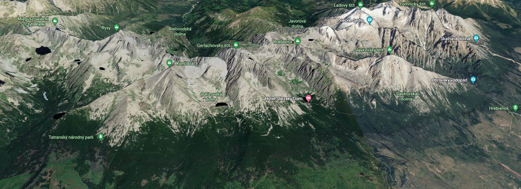
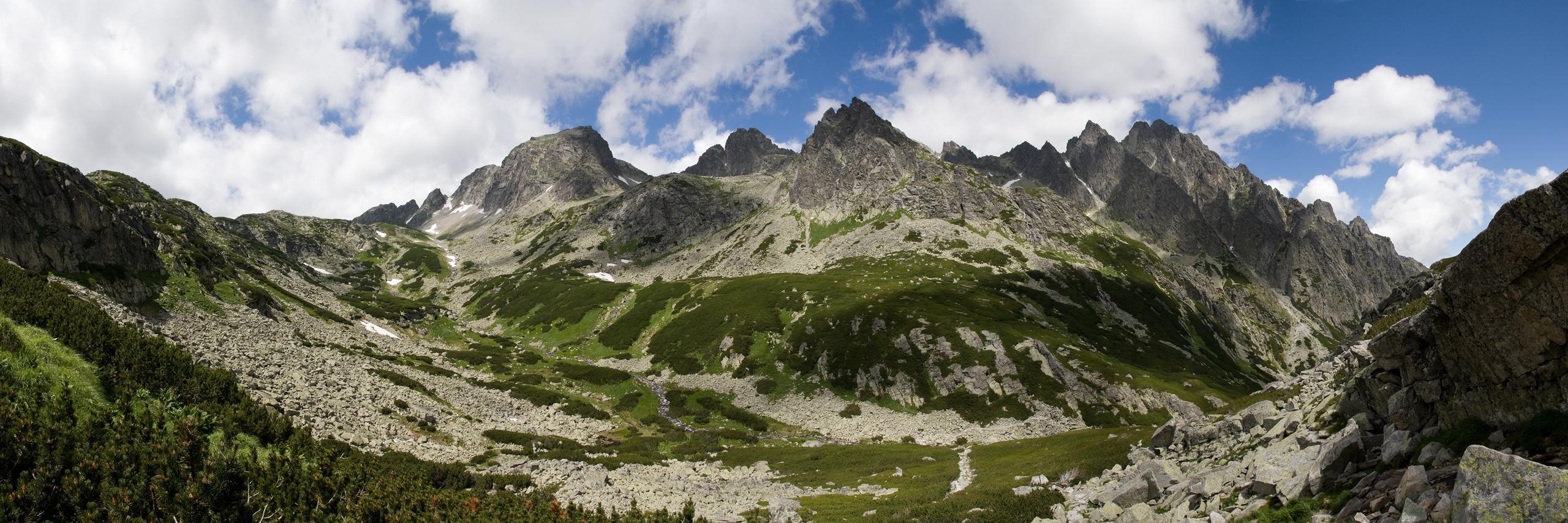
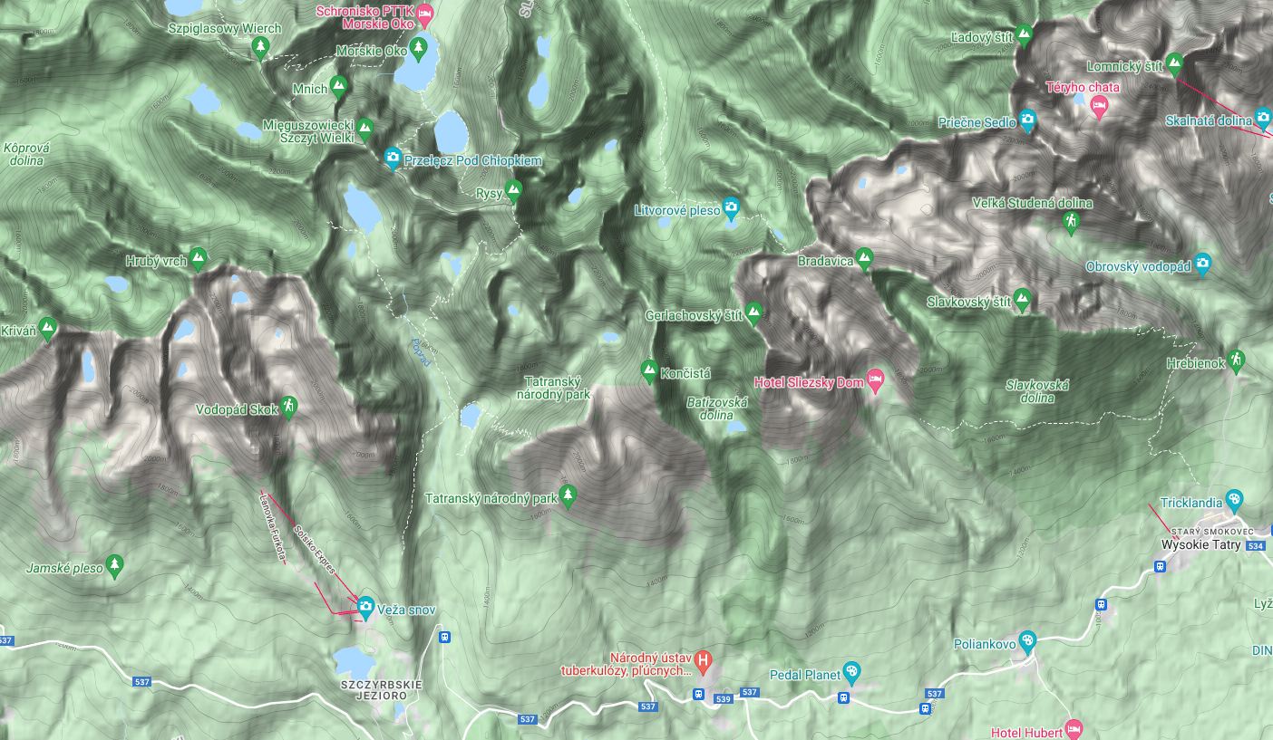
Below is a short movie showing what conditions are waiting for the climbers.

HOW LONG DOES IT TAKE TO CLIMB TO THE TOP?

Climbing Gerlach Mountain is an all-day hike. Coming to Gerlach from Sliezsky Hotel (where most of the trips start) and safely returning takes from eight to ten hours depending on the chosen route. Of course, weather and physical condition are also important. The hikes start early in the morning, in spring and autumn at 5-6 am, in summer at 4-5 am.

Why so early? First of all, to be sure to return before sunset, and secondly, to avoid bad weather, because mornings in the Tatra Mountains are often beautiful, but by noon clouds may gather around the summit and cover the view of the beautiful Tatra panorama.

PHYSICAL CONDITIONS TO CLIMB GERLACH

Average experienced tourist can climb Gerlach without any problems. If you can climb such peaks as Rysy, Kriváň or Slavkovský Peak within the time given on signposts or maps, don’t be afraid to climb Gerlach accompanied by a mountain guide.

Paths around of Gerlach Peak, source grupabiwakowa.pl

GROUP SIZE

The maximum number of people led by one guide tied to the rope is determined by the Technical Commission of NAHV SR (Slovak National Association of Mountain Guides).

In summer it can be no more than three people. In case of more demanding climbs (e.g. ascent of Martinka route) there can be no more than two persons per guide. In winter, the guide can lead no more than two climbers at a time.

Great Cold Valley, Tatra Mountains, Slovakia
Author Maros Mraz, Veľká Studená dolina. Source commons.wikimedia.org.

CLIMBING ON GERLACH WITH CHILDREN

(FIRST ask the guide with whom you are going to the summit if the age and previous physical preparation of your child will not be a problem in climbing!)

General assumptions:

Children over 7 years of age can participate in guided tours, including an ascent of Gerlach.

Rules to follow when climbing with children:

– There can be only one child under 15 in one group (no more than three people).

– The child should be in good physical condition.

– It is recommended to “test” your child first on a less demanding route, e.g. Lomnica.  The difference altitude is only about 400 m, but the hike includes climbing sections.

– The best time to climb with your child is in the summer. From the end of June to the end of September, when conditions are best, without snow cover.

– Your child should have all the gear and equipment necessary for a guided mountain hike.

ACCESS

A good option is to stay in Starý Smokovec or in Tatranská Polianka, two small villages located near the different trails leading to the mountain hotel “Sliezsky Dom”.

In the area, there are many cheap hotels, guesthouses and hostels.

Guesthouses, hotels near Gerlach mountain, you can find here.

Source, Google Maps.


TIDBIT

In 1896 Hungarians renamed Gerlach peak to Franz Joseph Peak (Ferencz Jozsef-csucs), Czechs and Slovaks in 1923 to Stit Legionarov, and in 1949 Slovaks changed the name of Gerlach to Stalinov Stit. Gerlachovský štít (Gerlach) has been obtain again since 1959.

Wielicki Staw i Śląski Dom,
Author Waldemar Tomczuk, Velické pleso and Sliezsky dom. Source pixabay (photo edited).

USEFUL LINKS

3D view of Gerlach mountain and surroundings.

https://bit.ly/3LSAdoL


The website where you can find offers of mountain guides organizing climbs on Gerlach.

https://bit.ly/3v3zOKE


Data with current weather conditions.

https://www.mountain-forecast.com/peaks/Gerlach/forecasts/2655


View from the summit in 3D (computer graphics).

https://bit.ly/3jGnbil

SUMMARY

Gerlach is not a mountain to conquer for everyone. To climb it you need to be in good physical condition and have some basic mountain climbing experience. It is also necessary to have properequipment and remember to find a guide who needs to be “booked” up to a month in advance. This applies mainly to the summer season because there are a lot of people willing to go on this type of trip. On the other hand, impressions and views from such trip will remain unforgettable and maybe in the future we will want to repeat the climb. But for a change, on a different trail than the one we choosed last time.

Jjmjbasket, source pixabay, Gerlach (photo edited).

Maros Mraz, Veľká Studená dolina, commons.wikimedia.org.

Maros Mraz, Veľká Studená dolina, commons.wikimedia.org.

Nikolett Emmert, pixabay, Gerlach Peak (on the left) i Lomnica Peak (on the right).

Rafik, Batizovské pleso and the massif of Gerlachovský štít, commons.wikimedia.org.

SHARE AN ARTICLE

SEE ALSO

The city of rocks in the Czech Republic

THE CITY OF ROCKS IN THE CZECH REPUBLIC

austria grossglockner

GROSSGLOCKNER ALPINE ROAD

The Partnach Gorge, Germany, Garmisch-Partenkirchen

PARTNACH GORGE

Subscribe
Notify of
0 Comments
Inline Feedbacks
View all comments