08.10.2026
LAKE TURKANA
Lake Turkana is one of the most incredible lakes in all of Africa, formed during the Pliocene epoch. Discovered in the 19th century by an Austrian officer and a Hungarian explorer, the lake only intensified paleoanthropologists’ desire to uncover further findings in this area. This place provides evidence of the existence of hominids more than a million years ago who inhabited these lands, hunted, and even fought among themselves.
DESCRIPTION
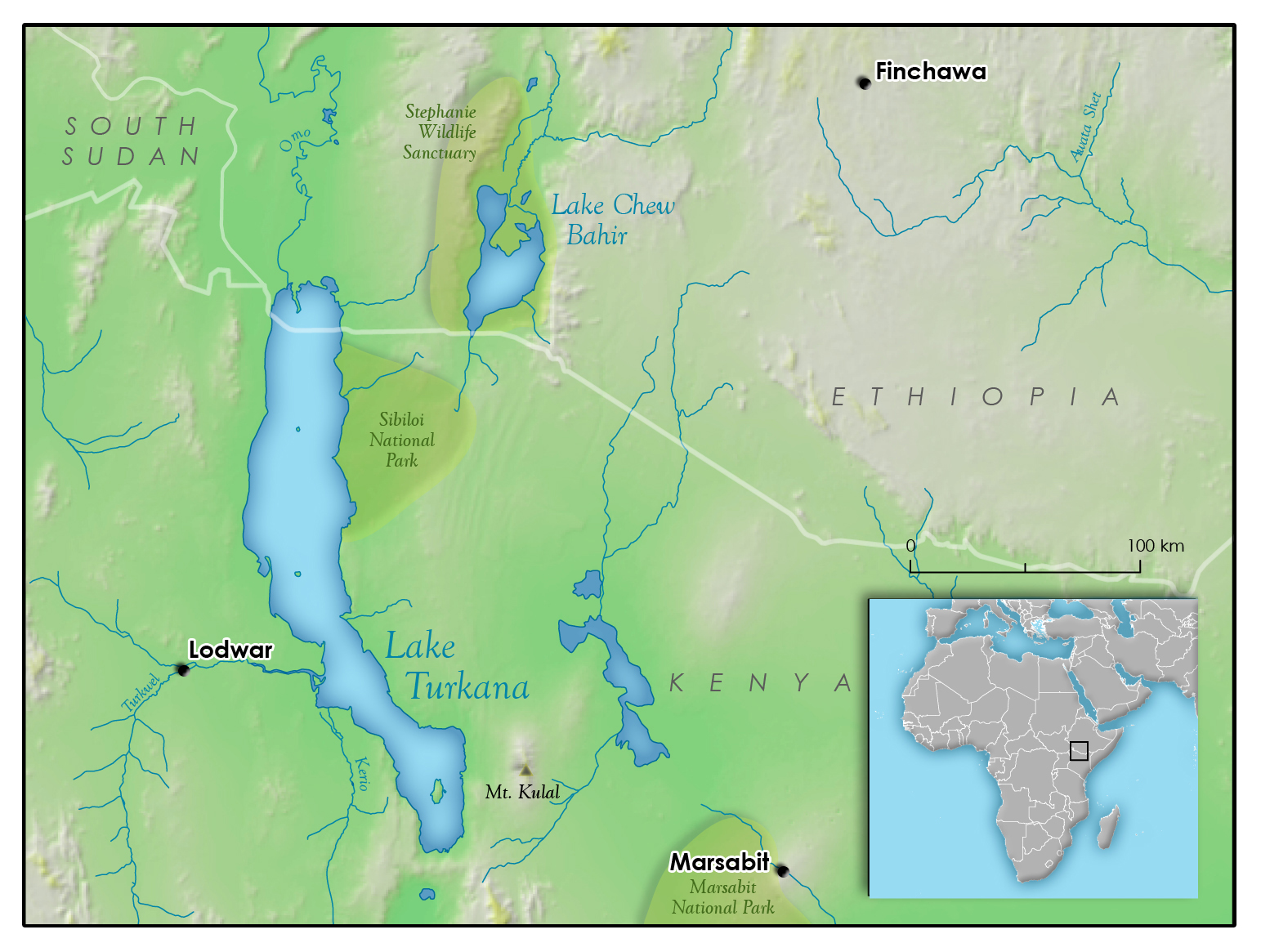
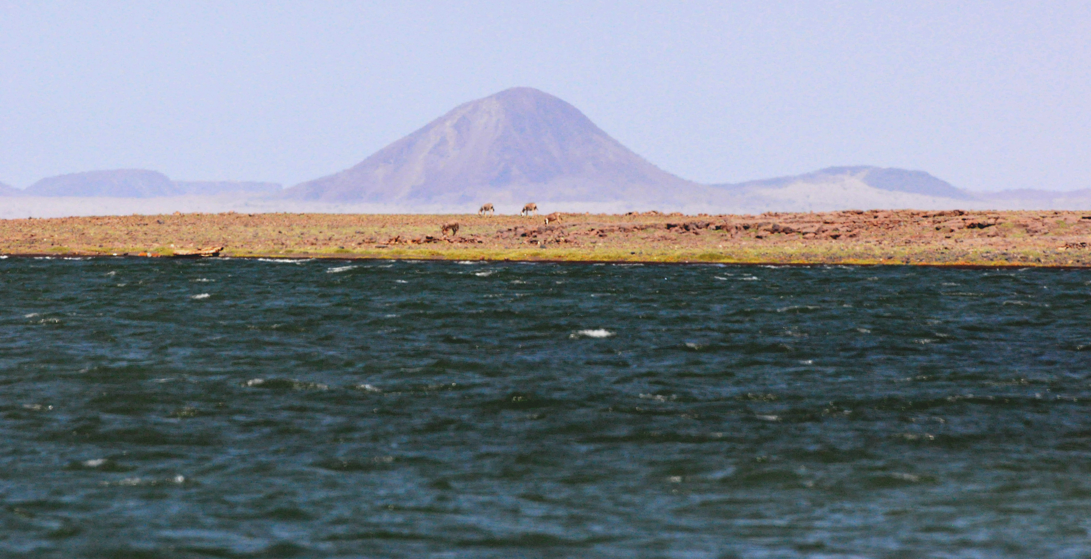
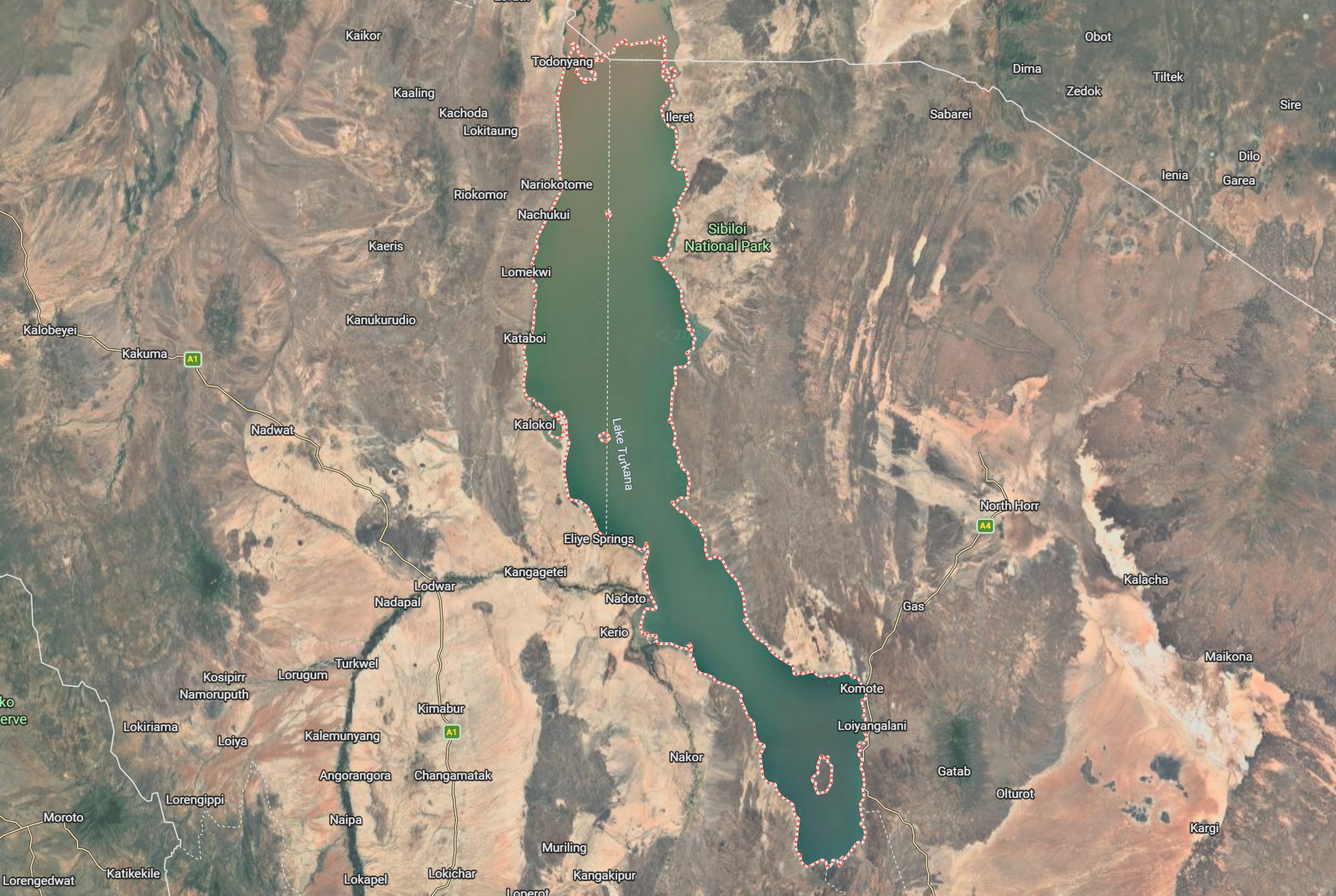
Lake Turkana, formerly known as Lake Rudolf, is located within the eastern branch of the Eastern Rift Valley in northwestern Kenya and southwestern Ethiopia. The lake formed approximately 4.3 million years ago and is the saltiest lake in Africa. It is 250–290 km long (figures vary by source), with an average width of about 32 km. Unlike other large lakes in this part of Africa, such as Lake Malawi, Lake Tanganyika, and Lake Kivu, Lake Turkana is relatively shallow. Its average depth is 30 meters, and its deepest point is 109 meters deep. It is the world’s largest permanent desert lake with alkaline waters. Its surface area is approximately 6,405 km², making it the fourth-largest lake in Africa and the largest desert lake in the world.
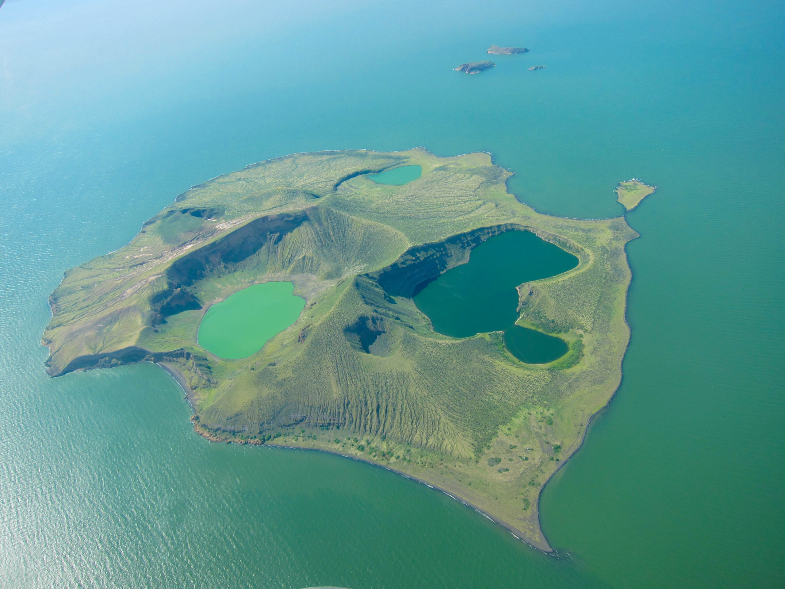
The shoreline is approximately 820 kilometers long and lies at an elevation of 375 meters above sea level. The eastern and southern coasts feature a large amount of volcanic rock, while the western and northern shores are characterized by sand dunes, sandy spits, and muddy plains. The three main islands—North, Central, and South—are of volcanic origin. The lake’s water comes from river tributaries; there is no surface runoff, so water loss occurs here solely through evaporation. Three rivers flow into the lake: the Omo, Turkwel, and Kerio; however, only the Omo is a constant river, which supplies 80–90% of the total water inflow (figures vary by source), which is approximately 18–19 billion m³ per year.
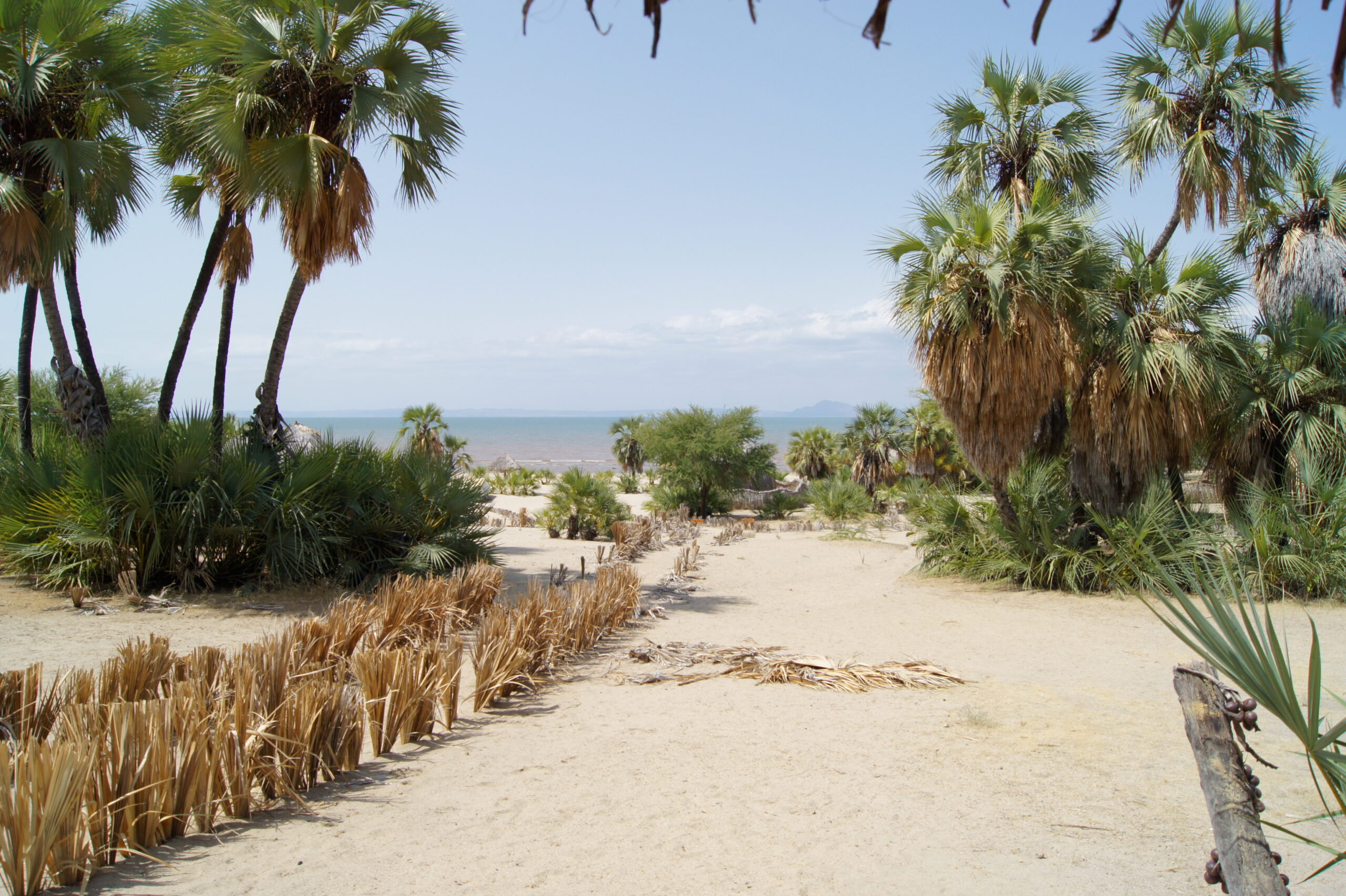
The area around the lake is characterized by a hot and dry climate with strong winds. Rainfall typically occurs here from March through May, and the total annual precipitation is approximately 250 mm. As a result, nearly the same amount of water that flows into the reservoir is lost through evaporation. Due to the prevailing climate, vegetation around the lake is limited mainly to scrub and desert formations. Grasslands appear only during the rainy season and disappear during drier periods.
Lake Turkana is home to the national park of the same name, which includes other parks such as Sibiloi National Park and the national parks on South Island and Central Island. Covering a total area of 161,485 hectares within the Lake Turkana area. Sibiloi National Park was granted national park status in 1973, while South Island and Central Island were officially granted as national parks in 1983 and 1985, respectively. These areas have been inscribed on the UNESCO World Heritage List. This area is managed and supervised by the Kenya Wildlife Service (KWS) and the National Museums of Kenya (NMK).
WHERE DID THE NAME COME FROM?
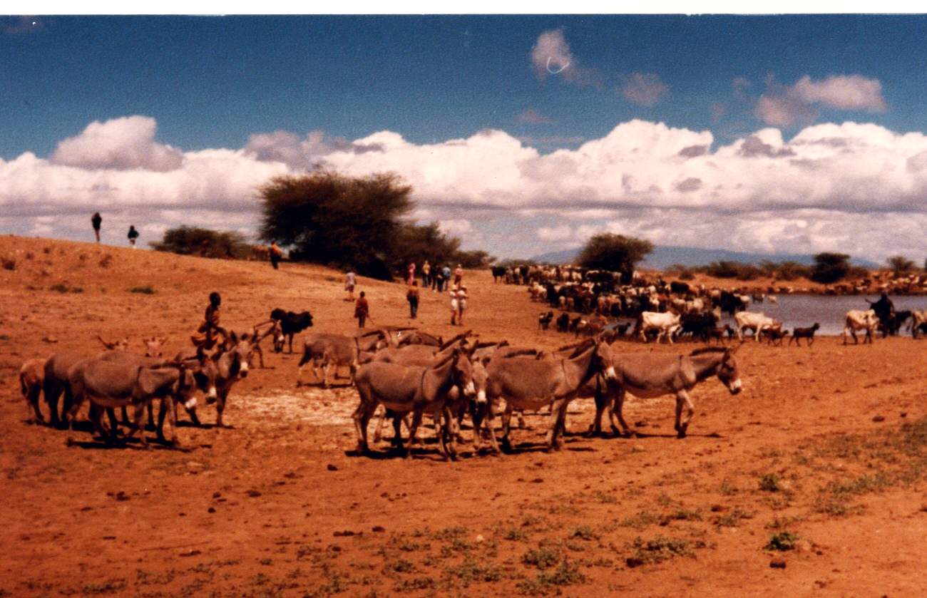
The population inhabiting this area consists mainly of nomadic herders, including members of the Turkana people. It was from their name that the lake received its current name in the 1970s. This decision was made by the Kenyan government under the leadership of Jomo Kenyatta, the first president of independent Kenya. Previously, the lake was known as Lake Rudolf. This name was given by traveler Samuel Teleki and Lieutenant Ludwig von Höhnel, who reached this location in 1888 and wished to honor the heir to the Austrian throne. Due to the distinctive color of its waters, the lake is also sometimes called the “Jade Sea” by the locals.
THE ETHNIC PEOPLE OF THIS PLACE
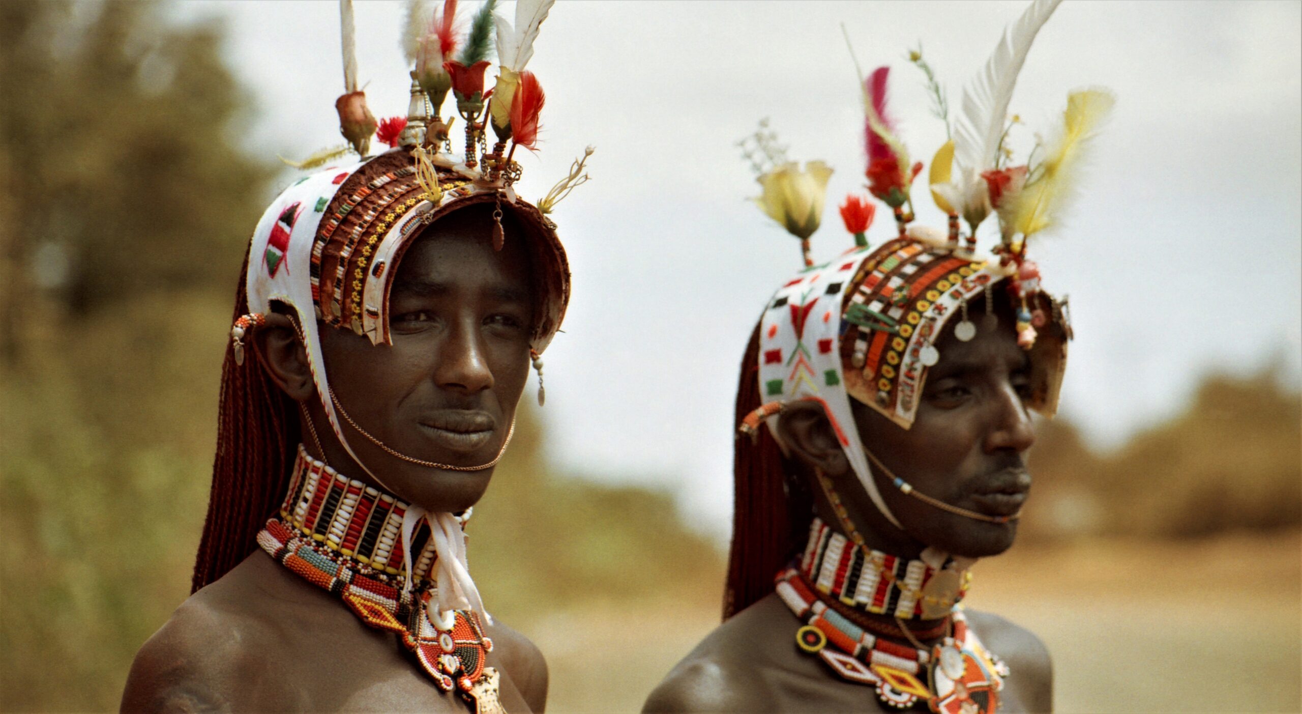
The Turkana are a people inhabiting the dry, sandy regions of northwestern Kenya, which stretch from Lake Turkana to the border with Uganda. They speak a language belonging to the East Nilotic group (a branch of the Nilo-Saharan language family), closely related to the language of the Teso people. It is believed that they arrived in the present-day region about 200 years ago from areas of modern-day northeastern Uganda, where the closely related Jie and Karimojong peoples still live today.
The Turkana are avid cattle breeders. They give their animals names and often sing to them. Cattle are marked with special clan symbols. Milk and dairy products such as butter, ghee, and yogurt play an important role in their diet. Hides, horns, and bones, on the other hand, have a significant role in material culture. In addition to cattle, they raise goats, sheep, and camels, which provide them with milk and meat and also serve as the “rate” paid by the groom to the bride. The Turkana practice transhumance (seasonal migrations with their herds), moving between permanent grazing areas and returning to their settled regions during the rainy season to cultivate millet and vegetables. Wild nuts, berries, wild game, and fish are also important sources of food for them. Their homes are temporary structures made of branches and palm leaves. They often protect themselves from predators with fences made of thorny shrubs. They use the same “materials” to build pens for their animals. A husband, his wives, and their sons, along with their families, usually live together or on neighboring farms.
The Turkana marry outside their clan, and after marriage, women join their husband’s clan. Men belong to one of two alternating age groups, known as the “Stones” and the “Leopards.” A son belongs to a different group than his father. In the past, members of both groups wore different ornaments, ate separately during feasts, and set out on war expeditions in separate units. Leadership in the settlement is exercised by the oldest men from multigenerational families.
Another ethnic group inhabiting this region is the El Molo people, who are primarily handled in fishing. It is generally accepted that these people originated from Cushitic groups that arrived from the northeast. It is the smallest ethnic group in Kenya, and according to ethnologists, there are only 40–50 “pure” members of the El Molo people. They most likely originally inhabited the areas north of Lake Turkana but were driven southward by militant tribes, leading to a significant reduction in their population. They sought refuge from their enemies on small coastal islands, although today part of this small community lives mainly along the shores of the lake itself.
Other peoples inhabiting the Lake Turkana region include the Samburu, Rendille, Boran, and Gabbra.
FLORA AND FAUNA
Lake Turkana, the saltiest of Africa’s lakes, is a unique place for studying plant and animal communities. The three national parks within this area serve as a stopover for migratory birds and are important breeding grounds for the Nile crocodiles. Its largest population in Africa is found here. They inhabit mainly Central Island, and the population numbers approximately 14,000 individuals. In addition, you can spot reticulated giraffes, lions, and Grevy’s zebras, flamingos, cormorants, Nile hippopotamus, many species of snakes, and over 350 different species of birds. Additionally, within Sibiloi National Park, you can encounter, among others, Grant’s gazelle, leopards, striped hyenas, oryx, the greater kudu, cheetahs, spotted hyenas, buffalo, and northern grysboks. The lake’s waters are home to about 60 different species of freshwater fish, including Nile perch, tigerfish, polypterus, and various species of tilapia.
The dominant plant species here include: imperata cylindrica, commiphora, acacias, Egyptian balsam, palms, stuckenia pectinata, and sporobolus spicatus.
WHAT WAS FOUND AT KOOBI FORA
At an area called Koobi Fora, north of Allia Bay (on the eastern shore of Lake Turkana, Kenya), many remarkable paleontological discoveries have been made. The first excavations took place in 1969, during which the remains of Paranthropus boisei were found (an extinct hominid species, a member of the australopithecines, which inhabited Africa approximately 2.3–1.2 million years ago). Later, bones belonging to Homo habilis (a fossil human species native to East Africa, dating back approximately 2.5–1.7 million years) were discovered. Over time, fossils belonging to other species of the homini family (Hominidae) were also found at this site, such as Australopithecus anamensis, Homo erectus, and Homo sapiens.
In the 1980s and 1990s, Koobi Fora was studied by, among others, the Leakey family (Richard and Meave Leakey), who discovered approximately 200–230 framework remains (figures vary by source) belonging to Homo habilis, Homo rudolfensis, Homo erectus, and four species of australopithecines (Australopithecus anamensis, Paranthropus boisei, Paranthropus aethiopicus, and Kenyanthropus). In addition, on the western shore of the lake, they found an exceptionally well-preserved skeleton of a boy between the ages of 9 and 13 (known as the “Turkana Boy”). The bones have been dated to approximately 1.5–1.8 million years ago.
Near the western shore of the lake, there are two other places where interesting discoveries have been made. At the Lomekwi 3 site (a dry riverbed), a set of primitive tools was found, including hammers, primitive anvils, and cutting tools, which were most likely made about 3.3 million years ago.
At the Nataruk site, located on the edge of a dried-up lagoon (which connected to the lake during periods of heavier rainfall), skeletons belonging to Homo sapiens were found, dating back 10,500–9,500 years. This site may provide evidence confirming the existence of “armed” conflicts between groups of this species. The remains excavated there had signs indicating violent death (bound corpses), and various fragments of weapons made of obsidian—a material rare in that region and at that time—were also found.
CLIMATE
Rainfall is very irregular and unpredictable, but the heaviest downpours occur during the so-called “long rains” season, which lasts from March through May. Air temperature measurements in the town of Lodwar, located about 60 kilometers west of Lake Turkana, show seasonal variability. The lowest temperatures occur in July and August, ranging from 19.5 to 30.5 °C, while during the hottest months (January and February), the thermometer can reach as high as 40 °C. Averaging night temperature measurements throughout the year, they range from 26 to 30 °C. There are also frequent, strong winds within the lake, with the dominant south-easterly direction.
APPROACH AND ACCOMMODATIONS
There are two ways to get to Lake Turkana. The first is to rent an off-road vehicle upon arrival in Kenya. When you type “off–road car rental Kenya” into a browser, a full list will appear—for example, on Google—so there’s no point in listing all the links here. Be sure to check the rental company’s location to make sure it’s in the area you want to explore (if possible) and is easily accessible, for example, from the airport. You can reach the lake by car from the west (via gravel roads) and from the southeast (via the A4/C77 road). The second option is to fly to one of the local airports. There are three near the lake: one in Kulapesa town (Loiyangalani Airstrip), another in Kalakol town (Kalokol Airport), and the third in Eliye Springs town (Eliye Springs Airport).
Recommended accommodations include apartments such as Oasis Lodge and Palm Shade in Kulapesa (which are located just a few hundred meters from the airstrip), SEER’S HAVEN and Fort Banya Resort in Eliye Springs, and Lake Turkana Guest House in Kalokol. In the town of Lodwar (located about 60 kilometers west of the lake), you can find affordable hotels such as the Luxora Hotel Lodwar and the Sandfields Lodwar Resort and Spa.
ENVIRONMENTAL AND ECONOMIC ISSUES
Lake Turkana faces many threats, most of which relate to economic issues. One of the most widely discussed issues is the construction of the three Gilgel Gibe dams—I, II, and III—on the Omo River in Ethiopia. The main objective is to generate electricity (hydroelectric power) to support the country’s development and for export to neighboring countries. Let us recall that the Omo River supplies 80–90% of all the water to the reservoir. The situation is further exacerbated by water uptake for irrigation in the Omo River valley, and it is estimated that water levels could drop by as much as 20 meters in the coming years.
Other threats to the local waters include pollution from human and animal waste, as well as the ongoing exploitation of oil reserves, especially on the western shore of the lake. In addition, in southern Ethiopia, between 150,000 and 200,000 hectares of forest are cut down each year for firewood. As a result, the exposed soil is subject to strong winds, which leads to the silting up of the lake. This could lead to a loss of biodiversity in the lake and the extinction of many fish species.
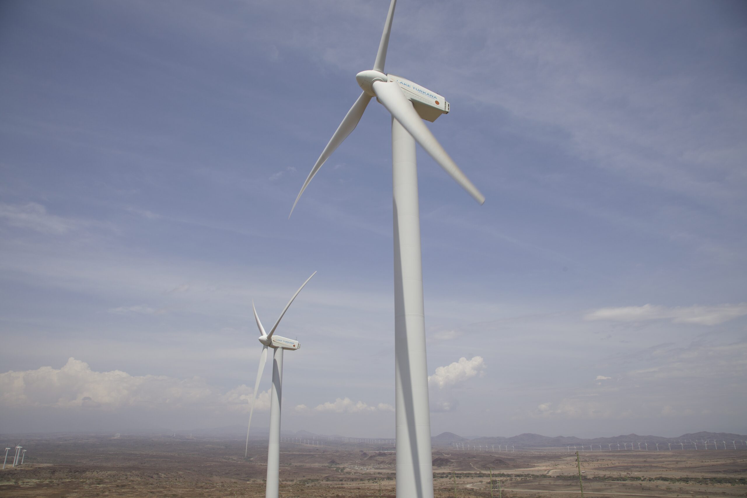
On the other hand, in Kenya, at Lake Turkana, there is a developed wind power project named Lake Turkana Wind Power (LTWP). It is the largest wind farm in Sub-Saharan Africa, consisting of 365 wind turbines. It is located about 12 km east of the lake in Marsabit County. Road construction and heavy transport have caused local soil erosion in this delicate ecosystem and contributed to the degradation of desert vegetation. This project has also led to the loss of pastures and land for the indigenous people of the region. You can watch a video on this topic below.
Another threat to the lake is an invasive and toxic plant, the Neltuma juliflora (whose seed pods contain neurotoxic alkaloids that are poisonous when consumed in excess by livestock), which “arrived” from Mexico/South America or the Caribbean. It also contributes to the further spread of malaria, especially during periods of drought when mosquitoes have limited access to sugar sources from native plants. It has become an invasive plant in Africa, India, Asia, and Australia.
TIDBITS
The park on South Island has been recognized by BirdLife International as an important refuge for local birdlife, as well as for migratory birds.
About 3,000 people are engaged in fishing here, and the annual catch amounts to approximately 4,000 tons.
In 1918, the Turkana people put up strong resistance to British attempts to conquer these lands, resulting in significant losses of life and livestock, but this did not lead to the establishment of British administration. The region was not fully conquered until 1942. Kenya gained its independence after the bloody suppression of the Mau Mau Uprising on December 12, 1963.
SUMMARY
Lake Turkana is certainly a beautiful place on the map of Africa. In that it is not a popular destination among tourists, we can count on the peace that will accompany us as we admire the local flora and fauna. However, let’s not forget that there are many threats in this region that could destroy the local harmony. Therefore, let’s educate ourselves, draw conclusions, and discuss the potential consequences that humans may inflict through their “investments.” And most importantly, let’s also bother to care for those places that were not created by humans.

author Kaka Namwaya, source commons.wikimedia.org.

Turkwel River and Lake Turkana, author Bernard DUPONT, source flickr.com.


Lake Turkana (2005), author Desc/Em, source flickr.com.


Author CaptChandra, source commons.wikimedia.org.
SHARE AN ARTICLE
SEE ALSO

CUESTA DEL LIPÁN

LORD HOWE ISLAND

VATNAJÖKULL ICE CAVE